Monday, February 05, 2007

JSW #2: Submarine Geomorphology

This is the second post for the Just Science week (Feb 5th-9th) on ...Or Something.
See the first post here.


from USGS; see more here

The resolution and coverage of both sea-floor mapping and subsurface seismic-reflection technology has grown by leaps and bounds over the last couple of decades. The above image is a perspective image of the Los Angeles, California area onshore topography and offshore bathymetry. Note the relatively flat continental shelf (green), very defined shelf edge, and variably steep continental slope leading to the deep sea (dark purple). The shelf edge and shelf is incised by submarine canyons that deliver terrigenous (i.e., derived from continent) sediment to the deep ocean. Many of these canyons and channels are sitting out at the shelf edge and are inactive now. During Last Glacial Maximum (~18,000 years ago) sea levels were much lower and the shoreline was essentially at the shelf edge. Some of these canyons are still active at present, however. On Friday of this week I will have a post about research I've been doing recently studying the flux of terrigenous sediment to one of these basins.


get original image here

This next image (above) is a map-view of the bathymetry offshore of Monterey, California (please check out MBARI's website for more great images of the sea floor). Monterey Bay is in the upper right of the image with the head of Monterey submarine canyon smack-dab in the middle between Santa Cruz to the north and the town of Monterey to the south. Monterey Canyon is a huge feature...follow it out seaward and the canyon transitions into a submarine channel with a beautiful meander that's barely on this image. The distance from the canyon head to that meander, called Shepherd Meander, is approximately 125 km (75 mi) to give you a sense of scale. The water depth at that meander is approximately 3400 m (11,150 ft). Monterey Canyon is one of the most studied and well monitored submarine canyons in the world. Turbulent gravity-driven flows carrying a lot of sand are responsible for carving out this fantastic feature over long time scales (hundreds of thousands to millions of years). This paper from 2004 by colleagues of mine, Andrea Fildani and Bill Normark, is a great resource for understanding the geologic history and sedimentary processes related to the formation of Monterey Canyon.


Three-dimensional seismic-reflection technology allows us to create maps of buried geomorphic features. The images shown at right and below clearly show beautiful meandering channels that were once on the sea floor (in very deep water) and are now in the subsurface. By analyzing 'slices' within the seismic volume we can map the evolution of the geomorphology through time. These images from a recent paper from Posamentier & Kolla (2003).


Utilized together, bathymetric images from the modern sea floor and seismic-reflection images from the buried sea floor are spawning new branches of geomorphology that are focused on deep-marine processes and evolution. I envision more and more collaborative efforts in the future among subaerial (i.e., on land) and submarine researchers of Earth surface processes.


Posamentier and Kolla, 2003, Seismic geomorphology and stratigraphy of depositional elements in deep-water settings, Journal of Sedimentary Research, Vol. 73, No. 3

Sunday, February 04, 2007

JSW #1: Sediment thickness in the world's oceans

For my first post of JSW (Just Science week, Feb 5-9), i'm going to introduce my field of study, sedimentary geology, with an illustration. Much of the rest of this week, I will be discussing more than you've ever wanted to know about the sedimentation along continental margins. Actually, I have no idea what i'll be posting about...that's my guess...you'll have to stay tuned.

The above figure, which can be found here, shows the thickness of sediment in the world's oceans and marginal seas. I love this map...it is really great to get a global view like this. Like many others investigating patterns of nature, it is necessary to look at all scales. This post starts out big....the whole globe. Subsquent posts will zoom in spatially as well as pull back temporally and get a sense of past conditions.

One of the first things to focus on is the continents of North and South America. At this scale the configuration (and history) of the tectonic plates clearly governs the patterns (see map of plate boundaries below). Note the asymmetry of sediment thickness....the eastern margins of the land masses have thick accumuations (the hotter colors) of sediment whereas the western margins do not. The active western margins consist of a subduction margin in South America, transform margin in southern North America, and subduction margin in northern North America at a very large scale. This activity, although it creates a lot of high relief nearshore producing sediment, is not the best place to preserve sediment over long time scales.


The accumulations along the eastern, or "passive" margins, are so thick because they've been piling up for 10s of millions of years. These two strikingly different tectonic settings should be kept in mind.

Another notable pattern on the map of sediment thickness is the Bengal submarine fan. This fan, which sits in the Bay of Bengal between India and southeast Asia is the single largest accumulation of sediment on the planet (extending for nearly 30 degrees of latitude from the margin!).

Big deal. So, you may be asking so what...why should we study these accumulations of sediment? I hope to show you with a series of posts why I think it's interesting from a scientific standpoint to figure these things out. From the small-scale processes of transporting/depositing sediment to the spectacular geomorphology present on the sea floor to the implications to studying Earth history.

And, by now, i'm sure most of you may have also noticed the spatial coincidence of some of the thicker accumulations with petroleum provinces. This is no coincidence for sure....where you pile up a bunch of sediment over a long period of time you get the perfect host for our world's (for better or for worse) lifeblood. I'm not going to go too much into this particular application of sedimentary geology...at least not this week. My aim is higher....I want to learn as much as I can from these sediments/rocks. I'm a data junkie...I'll admit it. I want to observe and characterize information about the Earth....i'll take it where I can get it. I've been working on a post about 'peak oil' from a sedimentary geologist's perspective....but not this week. This week, i'll be using this information to tell you something (hopefully) interesting about our planet.


map of tectonic plates found here

"Just Science" week on this blog (Feb 5th-9th)

I've joined a bunch of science-related bloggers in a week designed to be about Just Science. That is, posts will not be diatribes about the misuse of science by government (not that that's not fun), not rants about intelligent design in public schools (not that that doesn't deserve ranting), not a reference and/or commentary on a mainstream article, etc. ... But a post about some actual science. The goal is at least a post a day.

Good idea!

I'm not sure i'll make a post a day, but i'm sure gonna try.

Here's the feed: http://www.justscience.net/?feed=rss2

Sokal and Mooney Op-Ed in LA Times

See Chris Mooney's blog, The Intersection, for more introduction to this editorial that he and Alan Sokal co-authored in today's LA Times. It's titled Can Washington get smart about science?, and is a nice little piece of writing.

What I like is that Sokal has been known to criticize liberals and Mooney has a book about conservatives in government and their subversion of science. I like to see people team up like this and cut through the partisan crap. It's all too easy for people to stay on "their side", whatever that means. The partisan brain is a funny thing. People with strong partisan tendencies tend to automatically believe, agree, disbelieve, disagree with statements that have yet to be checked for its truthiness.

Sometimes when I stroll about the blogosphere I get severely turned off by ultra-partisan "liberals" spouting complete nonsense. Conservatives do the same, of course....I guess I don't find myself strolling about their internet neighborhoods though.

Anyhow....read Chris and Alan's article, it's good.

Where On (Google)Earth #4?

The only clue i'm gonna give for this one is that the boundary between shallow water (light blue) and deep water (dark blue) is very sharp.

Good luck!

Saturday, February 03, 2007

Commentary on commentary

Keep in mind, this is only one example of this kind of idiocy. Unfortunately, a lot of people get their "information" (opinion) from people like this. For those of you who don't know, Neil Boortz is a Rush Limbaugh-wannabe (sad). Apparently he and another author have written a very thoughtful book about tax reform that I hear good things about. I haven't read it yet, so I can't comment on that but that's not what this is about. This is about someone with a megaphone and a lot of loyal listeners (choir members) spouting stupidity about the recent IPCC report.

I neither have the time nor energy to deconstruct all of this...here's some of my favorite tidbits from his editorial titled "Why I Am Skeptical About Man-Made Global Warming"

A 21-page report from something called the "Intergovernmental Panel On Climate Change" has been released today...in Paris, no less...and as expected, it's predictions are dire.
Sweet...right off the bat, we get some anti-French sentiment. Always a crowd-pleaser.

But really, it makes sense that the global warming crowd would come to this conclusion. After all, global warming is a religion. The anti-capitalist enviro-nazis don't ever want the problem to be solved. After all, if global warming were to be solved tomorrow, what would they blame the United States for? They'd have to find some other reason.
The underlying motivation for being skeptical about this report is revealed in this introductory section of the editorial. It's not about science at all....it's about the anit-capitalist enviro-nazis...let's call them the ACENs. The ACENs have plotting to take over the world since the first Earth Day I think. This is key to understanding this point of view. By connecting "anti-capitalist" directly to the prefix "enviro" and then throwing in the evil noun "nazi" the stage is set.

He then goes into a bunch of bullet points that are weak, unsubstantiated, and have been torn down numerous times. But, remember, it doesn't matter because the connection between being "enviro", whatever that means, and anti-American has already been established. Let's look at a few of the points that actually mention climate science in some way or form (as fun as it is, we'll move away from the ACEN theories).

Because the sun is warmer .. and all of these scientists don't seem to be willing to credit a warmer sun with any of the blame for global warming.
Hmmm....reference? Of course, an editorialist can't be bothered with citing. This claim, however, does not fall under opinion. To say something like this requires some backing. But, I will say this...at least he doesn't discredit the actual warming. There aren't many of those left. It's mostly about cause now.

It wasn't all that long ago that these very same scientists were warning us about "global cooling" and another approaching ice age?
The very same scientists. Who are they? He, of course, doesn't provide a list. He wants his followers to picture a small group that meet in undergound lairs (sensu Dr. Evil) plotting to take over the world. Here in reality, we know that this report is the summation of hundreds of scientists from around the world and across disciplines.

How much has the earth warmed up in the last 100 years? One degree. Now that's frightening.
What an idiot. When the global average temperature was 5-6 degrees colder than now there was an ice sheet a mile thick sitting over my hometown in New York state

Because that famous "hockey stick" graph that purports to show a sudden warming of the earth in the last few decades is a fraud. It ignored previous warming periods ... left them off the graph altogether.
Please demonstrate the errors in this. Oh wait....all you have to do is assert that, I forgot. See this summary of the hockey stick graph debate.

Because global warming "activists" and scientists seek to punish those who have different viewpoints. If you are sure of your science you have no need to shout down or seek to punish those who disagree.
Seek to punish. Seek to punish?

What happened to the Medieval Warm Period? In 1996 the United Nations Intergovernmental Panel on Climate Change issued a chart showing climatic change over a period of 1000 years. This graph showed a Medieval warming period in which global temperatures were higher than they are today. In 2001 the IPCC issued another 1000 year graph in which the Medieval warming period was missing. Why?
Oooh...juicy. Conspiracy. More here.

There are about 160,000 glaciers around the world. Most have never been visited or measured by man. The great majority of these glaciers are growing, not melting.
The great majority....what is that 70%? Reference? Of course not.

Rising sea levels? The sea levels have been rising since the last ice age ended. That was 12,000 years ago. Estimates are that in that time the sea level has risen by over 300 feet. The rise in our sea levels has been going on long before man started creating anything but natural CO2 emissions.
One of my favorite things people like this do is confuse the issue by constantly bringing up facts about the Earth's climatic fluctuations. What about rate of rise instead of magnitude, Mr. Boortz? If you look at the sea-level curves for the last 12,000 years you see the rate of rise slow until about 5,000-6,000 years ago. Since then the rate of rise is very small, hence we've been at a "stillstand" in sea level (see Lambeck & Chappel, 2001).


During the last 20 years -- a period of the highest carbon dioxide levels -- global temperatures have actually decreased. That's right ... decreased.
Another assertion with no reference.

Why are global warming proponents insisting that the matter is settled and that no further scientific research is needed? Why are they afraid of additional information?
I definitely want to know what scientist ever said they didn't want more data.....that's all we want! We can't get enough of it...give me a break.

There's a lot more of this kind of stuff in that particular editorial as well as out there on the airwaves, TV, and internet. The "great majority" of it is repetition of the same assertions that are, at best misconstrued and, at worst downright false. The fact that these assertions are seldom referenced by people like Boortz is because he knows by citing a particular study he is inviting rigorous scientific critique of his information (which has been done already). By doing this in an editorial fashion he doesn't have to reference and he continue preaching about the real message: that the anti-capitalist enviro-nazis (ACENs) are plotting to take over the world.


Lambeck, K., and J. Chappell, 2001, Sea level change through the last glacial cycle: Science, v. 292, p. 679-686.

Friday, February 02, 2007

Day in the Life

Lab Lemming and Highly Allochthonous decided to answer the question: "What do scientists actually do?".

See what they do on a typical day here and here.

For me, not sure this is a typical day...it's Friday and I just finished a draft of a long paper 2 days ago and gave to advisor. But here goes anyway...

8:15-8:50: train ride into office
8:50-9:25: check email and make blog post about French turbidites
9:25-10:00: chat with colleague on phone who just started a tenure-track position this month, discuss possible future collaborations
10:00-11:15: update spreadsheet database and associated plots with new radiocarbon ages for Holocene sediments offshore southern CA; get excited about how well-constrained this basin is temporally
11:15-11:45: chat with colleague on phone about the above; directions to go for writing it up
11:45-12:20: lunch
12:20-2:00: research possible job opening; start application process
2:00-2:15: get information together for rock samples I need to start processing next week
2:15-2:45: look for said rock samples in inefficient and messy storage area in the attic of building i'm in
2:45-2:50: have a little freak out moment when can't find rock samples (they are all the way from South America!)
2:50: remember I already put them aside right under my desk...phew
2:50-3:40: search for paper online that i've been meaning to look at; found it and read abstract, intro, and looked at figures
3:40-now: write this blog post
after now-later: go home and go out to dinner with girlfriend and another friend in San Francisco


Pretty easy-going day all in all

Friday Field Foto(s) #10: Turbidites in the French Alps


Instead of one photo this week, i'm gonna show a series of photos from a trip I took to southeastern France last June. Most of my research is involved with characterizing and understanding the deposits of turbidity currents, or turbidites. Essentially, picture an underwater 'avalanche' of sand and mud. The sediment travels down a slope into the deep water in fast-moving turbulent flows. Additionally, this very outcrop is where, in the late 1950s Arnold Bouma developed what has come to be known as the 'Bouma sequence'.


The photo above and to the right is a succession of alternating sandstone beds and mudstone beds (note trees for scale).


A road snaked its way up this mountain so we were able to look the rocks in more detail in the well-exposed roadcuts.

This photo shows the character of bedding at a scale of a few meters. The thicker sand beds are typically a little coarser-grained and tend to be more resistant and stick out of the cliff. The finer-grained material is commonly in thinner beds and more recessive.

Statistics of bed thickness patterns have been done for many years on turbidites. The variability is so great from place to place that there doesn't seem to be a very systematic pattern. Some workers have documented some interesting relationships (Talling, 2001 has a good summary of this).


A lot of turbidite sequences include intervals of chaotically deformed material. It may look like good ol' tectonic deformation but it is the result of slumping and sliding of material on the sea floor. In steeper areas of the slope leading to the deep sea, material that was deposited may sluff
off as submarine landslides. The blocks can stay
relatively intact in many cases.


Here's a larger-scale view of a famous outcrop called Chalufy (note trees for scale). This face is cool because you can see the sand-rich bodies pinching out into the blue-gray fine-grained rock. If you notice there are two distinct sand intervals that successively pinch out as wedge shapes from left to right.

This represents the edge of the deep-marine basin. A series of sand-laden turbidity currents came down the slope and incrementally deposited material that started filling in this hole. This kind of complex stratigraphy is more the rule than the exception. These are not simple layers. These flows both create and respond to sea-floor morphology with channels, levees, fans...you name it. The challenge is to take a preserved ancient succession like this and interpret the processes and morphology that existed on the sea floor. From there we build up and start to understand how the basin filled, what controlled the patterns, and relate it to the tectonic evolution.

I'll be posting a bunch of web resources for turbidite research soon....still working on that.

IPCC report


This is clearly one the biggest science news stories of the day/week/month/year/decade and there's tons o' hype...so i'm not going to do a lot of commenting until I have a little time to look at it. Not that i'm any sort of authority...but I like to go over things at least a little bit before trying to summarize and/or synthesize.

The actual Intergovernmental Project on Climate Change (IPCC) report can be obtained here today (2/2/07). The last report was in 2001...this is a significant body of work involving hundreds of scientists from around the world. The review process to decide on the final wording was quite rigorous.

The one thing I'd like to remind people is that this, the first report in a series, is the scientific background. The full report about policy is forthcoming (although there is a short summary of that too). It is extremely important to separate these. Yes, of course they are linked...I don't deny that. But, we should emphasize the objective information at this point.

There will be tons of noise about this report from every direction.....don't read mainstream media summaries that try to present "both sides"...and don't read your favorite op-ed columnist's pre-emptive commentary. Just read the dang report!

If you got to the end of this post and are lazy...here's another link to the IPCC website to download the report. Do it.

RealClimate, as usual, has a great post and good discussion going here.

Thursday, February 01, 2007

Infant Ocean Basin


This is great. The quality and amount of data we are collecting these days regarding the movements of the tectonic plates is fantastic. This article in Science Daily talks about a study looking the East African Rift Valley....a proto-mid-ocean ridge.

The most dramatic event came in September 2005, when hundreds of deep crevices appeared within a few weeks, and parts of the ground shifted eight metres, almost overnight. More than two billion cubic metres of rising molten rock -- magma -- had seeped into a crack between the African and Arabian tectonic plates, forcing them further apart.
These researchers are going to sample this new rock. Because this process typically occurs at mid-ocean ridges, it is inherently challenging to take samples. The East African rift is in a very early stage of developing into an ocean spreading center. Once the relatively thin and dense oceanic crust begins to form, the basin will eventually fill with the ocean to create a narrow seaway.

Wednesday, January 31, 2007

The importance of the Hubble telescope

When put into service in 1990, the Hubble space telescope was supposed to last about 15 years. Thanks to servicing via spacewalks, it is still going pretty well. Unfortuantely, one of the cameras onboard has stopped working. The ACS (advanced camera for surveys) can detect light from the ultraviolet to the near-infrared end of the spectrum and has been invaluable for astronomers since it was installed in 2002.

"Technically speaking, it is more risk. Is it worth taking that risk? I would say yes. If I were the administrator, I would go save Hubble. I can't even begin to tell you all the technological advances Hubble has given us. More importantly, think what we can gain in its future," retired shuttle Cmdr. Jim Wetherbee says.
The images and information that the Hubble telescope has provided has led to significant progress in understanding our universe...they likely would not have happened by this point without it. It seems every couple of years, the telescope faces challenges, whether it be breaking down or the threat of losing funding. Let's hope NASA keeps servicing Hubble until the next generation space telescope is put into place.

Image above from Hubble Heritage.

Sunday, January 28, 2007

Woman (with iPod) in the Landscape


My very first post on this blog was about the famous "face on Mars" image. Here's an image from Earth that resembles the profile view of a woman. The shading under the chin and on neck is fantastic.

Put these coordinates into GoogleEarth (or GoogleMaps w/ satellite turned on):
50° 0'38.20"N 110° 6'48.32"W

This is in eastern Alberta, Canada.
Pretty cool, eh?

No, I don't look at GoogleEarth all the time...I found this here while browsing for science news.

Saturday, January 27, 2007

Where on (Google)Earth #3

Okay...I might be giving this away...but, a recent post on this blog is in some way related to this location. Good luck.

Go here to find out about 'Where on (Google)Earth?'

Friday, January 26, 2007

Friday Field Foto #9: Igneous intrusion cutting across folded strata

This week...another photo from Chile.

Here we got a good ol' geologic puzzle...the kind you'd learn in an intro class. Here we can use the intuitive law of cross-cutting relationships to determine the relative timing of events. First the sediments were deposited, then the lithified sediments (rocks) were uplifted and folded, then an igneous intrusion cuts across the fold. Finally, erosion reveals it all for us to see.

To see all the Friday Field Fotos, go here.
To see more photos of Patagonia, go here.

Thursday, January 25, 2007

NHL All-Star Game

I didn't watch the game...all-star games or pro bowls are kind of useless in a way. But, I'm pretty psyched that my team, the Buffalo Sabres (where I grew up), was well represented. Daniel Briere had 1 goal and 4 assists and was named MVP.

The Sabres have never won the Cup. They made it in '99 only to be defeated by the Dallas Stars in game 6. Before that, they haven't been in the finals since the early '70s. This could be the year...they are second in the league, first in the eastern conference (standings). Typically there's a couple teams that kick ass in the regular season and then s#@t the bed in the first round of the playoffs. That would suck.

Southbound Sand

I love sediment (I even like how it settles at the bottom of a cup of Turkish coffee). I figured the least I can do on this blog is comment on sediment in the news.

A few days ago the BBC published this article on their website about the shifting sands of the Sahara. The sand dunes are slowly, but surely, advancing their way south and pushing communities in Nigeria out of their way.

"What we do is that when the sand moves and buries our homes and farms and even our wells, we simply keep retreating southwards"

One of the issues, is that the villagers are continuously cutting down trees for firewood, which is opening a clear path for the sand to migrate through.

What to do about it? Well, there's not too much, especially for remote communities struggling to get by as it is. In other areas engineers have tried sand fences with limited success. Check out this article that discusses the mechanics of dune migration in a little more detail.

Photograph from www.sahara-photo-tour.com

Tuesday, January 23, 2007

Where on (Google)Earth #2

Alright...let's try another one.

If you want to play...go here to find out what I'm talking about.

Sunday, January 21, 2007

"National Park Service under orders to suspend its belief in geology"


UPDATE (1/28/2007):

Apparently, the watchdog group called PEER (Public Employees for Environmental Research) that originally put out the press release I linked to in the original post (see below) was either not being totally honest or there is some miscommunication somewhere.

Skeptic magazine reported on this story but when they started looking into it further, they figured out they were "duped" by PEER. Read statement from Michael Shermer, editor of Skeptic magazine, here.

A reader of Skeptic who contacted PEER had this to say:
"When I challenged that PEER guy to show me some evidence and provided him evidence to the contrary, he didn’t have much. I would say PEER did more than jump the gun. I’d say they are spreading misinformation."

It is really unfortunate that PEER had to do this. From their website it appears they do some important, relevant, and honest activism. Unfortunately, this kind of tom-foolery really takes a bite out of their credibility as a "watch dog".


-----------------------------------------------------------
ORIGINAL POST (1/21/2007):
Please read this regarding the unsettling happenings within the National Park Service (NPS) and how to inform park-goers how old and by what processes the Grand Canyon formed.

“In order to avoid offending religious fundamentalists, our National Park Service is under orders to suspend its belief in geology,” stated Public Employees for Environmental Research (PEER) Executive Director Jeff Ruch. “It is disconcerting that the official position of a national park as to the geologic age of the Grand Canyon is ‘no comment.’”

The presence of the book for sale in the visitor center bookstore that lays out (presumably) how Noah's flood was responsible for both the deposition of the ancient sediments exposed in the canyon AND the carving of the canyon is bad enough.
What's funny is how this administration made a big deal last year about the 'American Competitiveness Initiative' to help increase the quality of science and technology-related education. This is how they do it?! How does promoting this absolute fantasy enable Americans to be more competitive?

“As one park geologist said, this is equivalent of Yellowstone National Park selling a book entitled Geysers of Old Faithful: Nostrils of Satan,” Ruch added,


Here's the letter from the park employees to the NPS director expressing their distaste for this non-scientific malarkey.

Thanks for the link, KS

Photograph above taken by me in summer of 2006.


Friday, January 19, 2007

Friday Field Foto #8: Cretaceous shoreline deposits

I've missed the last few Fridays...

The Book Cliffs are in central Utah and western Colorado and are famous for their spectacular outcrops of Cretaceous shoreline deposits. The seaway, which once stretched across the whole of North America from the Gulf of Mexico to the Arctic Ocean, left a fantastic record of relative sea level changes in these sedimentary rocks. The landward or basinward movement of the shoreline can be mapped along the Book Cliffs by identifying the various sedimentary environments (coastal plain, beach, shoreface, shelf, etc.) in the record.

The map above illustrates this paleogeography nicely. Note how much of Colorado is part of this seaway at this time. Eventually, the rivers and shorelines (as recorded by the stratigraphy) march across Colorado too. This image taken from a fantastic website by geologist Ron Blakey at the University of Northern Arizona. Check it out.

Thursday, January 18, 2007

Where on (Google)Earth #1?

Okay...here's an idea. Every once in a while I'm going to grab an image of somewhere on this planet using GoogleEarth. It's up to the readers to determine or guess where it is. It will usually, although maybe not always, be a natural feature of the Earth that is highlighted. Sometimes I might be zoomed in, other times it'll be a wide shot. Sometimes it might have something to do with an area or phenomenon discussed in the news...sometimes not.

If you can't tell me exactly where it is...then tell me something about the natural feature that is shown.

If you get it right....well, that's it, you get it right....i'm not gonna give you a prize or anything. Who do you think I am?

Check out this blog for a similar GoogleEarth type of thing in quiz form.

The first image might be easy for some....

Click on image to see larger version

Wednesday, January 17, 2007

Evangelicals and Scientists

I simply don't have the time at the moment to comment thoughtfully and thoroughly about this article. Nonetheless, it deserves some attention for all those worried about the state of science in the face of the rise of the Age of Unreason.

"God will judge us for destroying the Creation. Therefore, we as evangelicals have a responsibility to be even more vigilant than others," Cizik told a news conference.

"Science can be an ally in helping us understand what faith is telling us," he said. "We will not allow the Creation to be degraded, destroyed by human folly."

There is a growing trend of so-called 'Green Evangelicals' who believe they need to be responsible stewards of the Earth. All-in-all...this is good. My hope is that in this process scientists can demonstrate that being good stewards of the Earth also makes sense from a scientific point of view.

(thanks for the link, BK)

Tuesday, January 16, 2007

Awesome jazz and groove podcast

For those podcast subscribers out there, I found a great monthly music show that highlights groovy jazz
(including all the sub-sub-sub-genres of acid jazz, afro-beat, bop, cool jazz, cosmic jazz, dub, downtempo, electro-jazz, fusion, future jazz, groove jazz, jazzatronic, jazz dance, jazz-funk, jazz-rock, kozmigroov, modal, phusion, progressive, modern, nu-jazz, soul-jazz, spiritual, and world).

It's called BendingCorners and is nice because the creators are DJs who spin sets that are about an hour or a little more of continuous music (i.e., one, long audio file)...typically within a 'theme' for that month. You can either subscribe to the podcast or just download the files directly. Although they only come once a month, if you like it, you can download from the archive. If you get really into it (I wish I had the time), they have the playlists for each set and you can explore the original stuff.

If jazz and groove is not your thing, you should at the very least download the tribute to James Brown (the Dec 2006 set called 'Mr. Dynamite').

Monday, January 15, 2007

Expanding Spheres


The geoblogosphere...at least from my limited perspective...is expanding today. Fellow bloggers of mostly geo-related topics are linking to each other. Check out the list on the sidebar called 'Earth Science Blogs' from time to time...I will be adding more and more.

Special thanks to Highly Allochthonous for getting this going...check it out.

Image at right here.

Sunday, January 14, 2007

Procrastination

In an effort to not do any work, but still sit at a computer pretending i'm working...i've spent time updating and modifying this blog with a new look and more links at the side.

A fellow geo-geek from Stanford (now a post-doc at Syracuse) has a nice blog called Apparent Dip ... check it out.

Friday, January 12, 2007

The myth of the "opposing view"

"Condoms don't belong in school and neither does Al Gore."

I can't resist commenting on this article...even if no one reads it...and even though I should be working right now. Below are excerpts from the report (click on link above to see original) and then my snide remarks in this font.

After a parent who supports the teaching of creationism and opposes sex education complained about the film, the Federal Way School Board on Tuesday placed what it labeled a moratorium on showing the film. The movie consists largely of a computer presentation by former Vice President Al Gore recounting scientists' findings.
At least this reporter lays it out from the start the kind of person we are dealing with. I have to give them some credit for that.

"Condoms don't belong in school, and neither does Al Gore. He's not a schoolteacher," said Frosty Hardison, a parent of seven who also said that he believes the Earth is 14,000 years old. "The information that's being presented is a very cockeyed view of what the truth is. ... The Bible says that in the end times everything will burn up, but that perspective isn't in the DVD."
Please re-read the last sentence again. That's right..."An Inconvenient Truth" does not sufficiently cover the details of the end times, which apparently gets even warmer. Hmmm....14,000 years old, what happened to 6,500 or whatever?

Hardison's e-mail to the School Board prompted board member David Larson to propose the moratorium Tuesday night.
"Somebody could say you're killing free speech, and my retort to them would be we're encouraging free speech," said Larson, a lawyer. "The beauty of our society is we allow debate."

What an absolute coward. What kind of school board member is swayed by someone who says that not including the details of the 'end times' in a documentary about climate change is cockeyed?

School Board members adopted a three-point policy that says teachers who want to show the movie must ensure that a "credible, legitimate opposing view will be presented," that they must get the OK of the principal and the superintendent, and that any teachers who have shown the film must now present an "opposing view."

Okay, here's where we start to get to the good stuff. Again...props to the reporter for putting "opposing view" in quotes. This is where the general public, or at the very least school board members, need to stop and think for a moment. I would like to know the details of the credible and legitimate opposing view. What exactly are they opposing? The fact that the climate is changing or that Al Gore made a movie. What am I missing here.

The requirement to represent another side follows district policy to represent both sides of a controversial issue, board President Ed Barney said.
"What is purported in this movie is, 'This is what is happening. Period. That is fact,' " Barney said.

Okay, I see...it's a controversial issue. What exactly is under controversy? In fact there is no controversy regarding the science. Yes, of course, there are numerous ongoing debates about the intricacies and workings of the climate system...but that would not change the foundation of this movie. I'll give them the benefit of the doubt...perhaps they are not saying that climate change itself is under question, but rather that human civilization is causing it.

Students should hear the perspective of global-warming skeptics and then make up their minds, he said. After they do, "if they think driving around in cars is going to kill us all, that's fine, that's their choice."

Again...what exactly is a 'global warming skeptic'? What are they skeptical about!?!? Why should students hear the opposing view? Should they start bringing in people that think the Earth is flat, or that the Earth is the center of the solar system, or that gravity does not exist? Oh wait...I think there's some opposing views about who killed JFK or who masterminded 9/11 circulating too...I wonder if this school board president would allow that. That last sentence is ridiculous...this is a school board president?

While the question of climate change has provoked intense argument in political circles in recent years, among scientists its basic tenets have become the subject of an increasingly stronger consensus.

Thank you (polite applause)

"In the light of new evidence and taking into account the remaining uncertainties, most of the observed warming over the last 50 years is likely to have been due to the increase in greenhouse gas concentrations," states a 2001 report by the Intergovernmental Panel on Climate Change, which advises policymakers. "Furthermore, it is very likely that the 20th-century warming has contributed significantly to the observed sea level rise, through thermal expansion of seawater and widespread loss of land ice."
The basics of that position are backed by the American Meteorological Society, the American Geophysical Union, the American Association for the Advancement of Science and the National Academy of Sciences.

Last I knew, there were a few cockeyed scientists in those organizations (nearly 50,000 in AMS and AGU alone).

The incident started when Hardison (the end times guy from above) learned that his daughter would see the movie in class. He objected. Hardison and his wife, Gayla, said they would prefer that the movie not be shown at all in schools.
"From what I've seen (of the movie) and what my husband has expressed to me, if (the movie) is going to take the approach of 'bad America, bad America,' I don't think it should be shown at all," Gayle Hardison said. "If you're going to come in and just say America is creating the rotten ruin of the world, I don't think the video should be shown."

Bad America...sit America, sit...no, drop it....America!!
There we have it! It's not about science or policymaking at all with the parents that are the source of the complaint! It's about doing your patriotic duty and denying that America can do no wrong. So, I guess showing a movie with the opposing view would be.....Rocky IV!

The policy, titled "Controversial Issues, Teaching of," says in part, "It is the teacher's responsibility to present controversial issues that are free from prejudice and encourage students to form, hold and express their own opinions without personal prejudice or discrimination."
"The principal reason for that is to make sure that the public schools are not used for indoctrination," Larson said.

This is how they do it. The illusion of controversy...radio and TV talk show pundits spouting unfounded nonsense do not constitute a scientific debate. This is the myth of the opposing view. Otherwise, they would not be able to do this. It's the same with 'intelligent design' ... a subject for another time ... the proponents launched a massive campaign about opening children's minds to other viewpoints and "teaching the controversy". If you create a controversy, then you can teach it....perhaps they should have a class where they teach about teaching controversy and controversial that is.

Bottom line, Mr. Hardison -- this is a public school. Home-school your kids if you don't like it. You can teach them all the ridiculous things you like about the age of the Earth, the end times, etc.

The last comment below, however, offers some hope.

"I think that a movie like that is a really great way to open people's eyes up about what you can do and what you are doing to the planet and how that's going to affect the human race," said Kenna Patrick, a senior at Jefferson High School.


Thursday, January 11, 2007

Gambling

www.caglecartoons.com

Monday, January 08, 2007

Desktop Earth

If you like satellite pictures of the Earth and the time of day...you can get them both with this cool little desktop program. It's called Desktop Earth (get it here) and shows a satellite mosaic map of the world with the current time of day and time of year (updates every 5-10 min). If it's the middle of the night where you live (what time zone your computer is set for) then it shows that part of the planet in the dark and with nightime lights...and vice-versa. It also has a setting for cloud cover. Althought the clouds are not real-time snapshots, they are only delayed by a few hours and, at a large scale, pretty accurate.

Thursday, January 04, 2007

Drumming and piano by a guy who plays neither

This guy spliced together audio and video of himself at a drumset and piano to create a music piece...and a pretty cool video. It starts out a little slow...give it a chance. Click on photo above to go to the video at YouTube (thnx for link BK).

Tuesday, January 02, 2007

Imagining the 10th dimension

A good buddy found this website...it explains how the universe can have more dimensions than the four we are familiar with. It's a little mind-bending but pretty cool.

Happy new year!

Sunday, December 17, 2006

Angel Island

A couple weeks ago we went to Angel Island, which is the biggest island in the San Francisco Bay. It's a great day trip...you take a ferry over from Fisherman's Wharf in the morning, hike around for a few hours, and then take a ferry back in the late afternoon.

The photo above is from the southern flank of the island with downtown San Francisco in the background and Alcatraz in the middle ground.

Check out Angel Island State Park website for more info.

Saturday, December 16, 2006

Friday Field Foto #7: Stack of deep-water deposits

(a day late)

Here's another shot of my field area in southern Chile. The more resistant cliff-forming rocks are mostly sandstone and the gray-brown slopes are shale. These sedimentary rocks were deposited on the sea floor about 65-70 million years ago (kind of around the time the dinosaurs became extinct). Good stuff.

Wednesday, December 13, 2006

Under the sea

I've spent the better part of the last 6 years studying deep-marine sedimentation (how dirt from the land gets to the bottom of the ocean). One of the coolest things about this are images like the above. It is a perspective view looking north of onshore and offshore southern California. I'm constantly fascinated by the landscape on the sea floor....mountains, valleys, canyons, channels, plains. Some of those mountains are sticking up out of the water as islands. We have the surface of Mars mapped better than our own ocean floor. It's like looking at another planet...I love it! Currently I'm studying Santa Monica Basin, which is towards the top of the image...the yellowish-greenish patch to the left of Los Angeles.

If you want to explore the world's sea-floor topography, you can download this Java program that accesses online databases (kind of like GoogleEarth but for underwater). It's called GeoMapApp, it's a little clumsy and sluggish sometimes, but still pretty fun.

Monday, December 11, 2006

Augusto Pinochet and the other 9/11

Because I've been traveling to Chile for research for the last few years, I've naturally taken an interest in their history, culture, and politics.

Yesterday Augusto Pinochet, 91, died. Pinochet led a military coup that ousted democratically-elected president Salvador Allende on September 11, 1973. The U.S. secretly backed this coup as part of their 'anti-communism' program of that era.

Pinochet ruled Chile as a right-wing military dictator until 1990. Thousands of people (there's debate about how many) were rounded up, tortured, and killed for their known or inferred dissent of his politics (if you weren't with him, you were against him). There were detention and torture centers, concentration camps essentially...all that good stuff military dictatorships are made of.

He has a long list of human rights violations against him and has evaded justice over the last decade with the excuse of failing health.

Many Chileans view him as a brutal fascist dictator that ended democracy, while others view him as someone who brought economic growth to Chile with fierce free market policies (which is why the U.S. gov't backed him).

You can learn more about this subject here, here, or here.

Friday, December 08, 2006

Friday Field Foto #6: Sand-rich turbidite deposits

This is in the desert of west Texas...in the Delaware Mountains. I spent many weeks here when I was working on my master's (2000-2003). Because of the school calendar, we had to go in the summer mostly. It was frickin' hot! But a beautiful place, a lot of rock. The cool thing about this place is that each of those cliff-faces has the same layers of rock...so, we were able to map out how they changed in some detail.

Check out more photos of the Delawares here.

Wednesday, December 06, 2006

Why does it have to be water?

Okay, I know...another Mars post.
But, earlier today the news agencies picked up on a story about features seen on Mars that may have been formed by liquid water. The image at right is zoomed in on one of these deposits. The lighter-colored material is being interpreted as possibly the result of flowing water.

Why does water need to be involved at all? In fact, why does liquid need to be involved? Depending on the material that makes up this steep slope, it could simply be a gravity failure of loose, granular material that flowed and created this deposit. Sand dunes do this all the time. What is the gravity like on Mars compared to Earth anyway....how might loose, granular material behave?

My point is that water is not necessarily required to produce this feature.

What's worse is that once the words 'water' and 'Mars' are spoken in the same sentence, reporters and newspapers make giant leaps of inference and start talking about 'life on Mars'.

Granted, I haven't actually read the scientific report that is coming out....my guess is that the news is overstating what the authors may be implying in their work.

Friday, December 01, 2006

Friday Field Foto #5: Pygmy owl

Although we are usually looking at rocks, it's impossible to not have encounters with wildlife while in the field. One morning while we were having breakfast at our campsite in southern Chile, this pygmy owl hung out on a tree branch near us for about 20 minutes. This little guy is about the size of your fist.

See more photos of mine from Patagonia here.

Tuesday, November 28, 2006

Mars Global Surveyor...R.I.P. (1996-2006)

© 2006 by Malin Space Science Systems, Inc.

NASA lost contact with the Mars Global Surveyor (MGS) nearly a month ago. It appears it is now lost. MGS had a good run...orbiting the red planet taking high-res photos of the surface. It contributed to the success of the Rover mission by helping find landing spots.

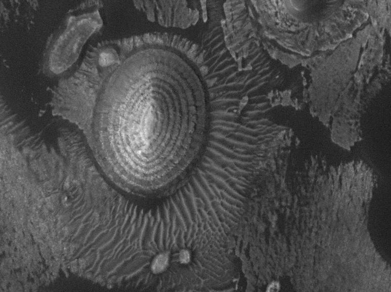
The above photo shows flat-lying sedimentary rocks eroding into an oval-shaped hill that has linear sand dunes around it.

Check out the online database of MGS images.

Friday, November 24, 2006

The view from Berkeley

I snapped these on Thanksgiving evening. They are taken from the Berkeley hills looking west across the bay toward San Francisco. In the picture above San Francisco is a little right of center...you can bareley see the silhouettes of the buildings. The Golden Gate bridge is against the far right of the photo. Note crescent moon.
The picture below is zoomed in on the Golden Gate bridge. Alcatraz is in the foreground and you can see the Farallon Islands way in the background.
Click on images to see a high-res version.

Yes, it's expensive to live here...but, sometimes you get what you pay for.

Wednesday, November 22, 2006

RealClimate.org

RealClimate is a blog-style website put together by several scientists who are actively study the Earth's climate system. If you're already a science geek then you can keep up with the latest misleading or just plain wrong information spewed out by editorialists. These guys are good at untangling the sometimes confusing or seemingly contradictory information that is given to the general public. Because it is a blog, there is a chance to reply to the topic and get a discussion going. A lot of the people that participate in this are also climate scientists...so you get a chance to "listen" in on the discussions they are having.

If you are new to the types of data thrown around and how the climate system works, in general, then check out the index page first. There's a lot of good info in there.

Saturday, November 18, 2006

Friday Field Foto #4: Patterns in the beach

A day late ...
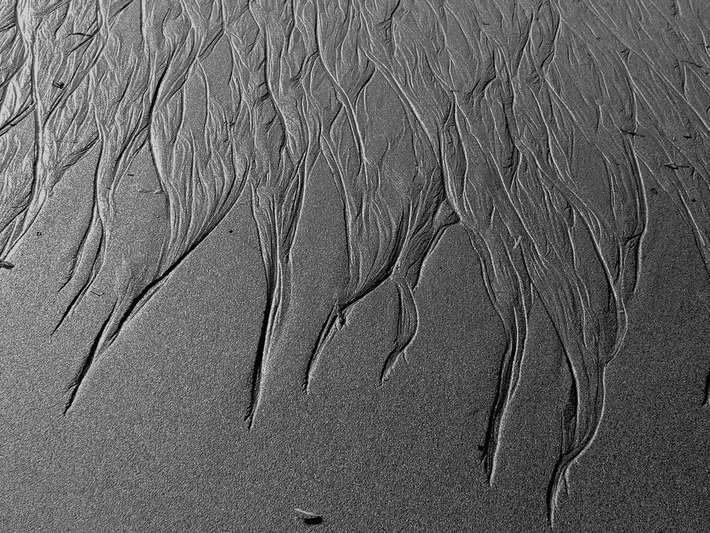
Here's a photo I took this October while walking on a beach up near Eureka, CA. These little erosional rills formed in this one area of the beach. You can see how the sand was re-sedimented into some neat patterns just a few feet downhill (towards the top). The width of the frame is about 3 or 4 feet across.

Monday, November 13, 2006

Giant storm on Saturn

nasa.gov

This hurricane-like storm is 5,000 miles across (about 2/3 the size of Earth) with estimated winds of 350 mph. Click here to read more about it. Also note in the blue and red images above...all those spots are smaller storms within the big one!

Saturday, November 11, 2006

Those Founding Fathers ... dang, they were smart

Alright, the elections are over. The Democrats will have control over Congress. Will everything now be all peachy and wonderful? Of course not. There is still a lot of important things to take care of.

What is important is that now unchecked power will be checked. Checks and balances. Whether it be Republicans or Democrats...neither should control all branches of government for any lengthy period of time. Corruption will always result. This is the system our founding fathers envisioned. This is why we have mid-term elections in the first place.

The Republicans are gonna call the Dems "obstructionist" ... damn straight. If there is failed policy and plans to make more, then it should be obstructed. Hopefully both sides will practice what they are preaching this week and work together.

Monday, November 06, 2006

I agree with conservatives (at least this one)

This editorial from the magazine The American Conservative, called "The GOP Must Go", is one of the more succinct arguments against keeping one-party rule in the 109th Congress and how this election tomorrow really is a referendum on the executive branch.

Prominent conservative thinkers (with an emphasis on thinking ... not the Limbaugh, O'Reilly morons screaming nonsense to the masses) have important and relevatn things to say. This article is an example of that.

"On Nov. 7, the world will be watching as we go to the polls, seeking to ascertain whether the American people have the wisdom to try to correct a disastrous course. Posterity will note too if their collective decision is one that captured the attention of historians—that of a people voting, again and again, to endorse a leader taking a country in a catastrophic direction. The choice is in our hands."

Conservative, liberal, progressive, independent ... y'all should read it.

Sunday, November 05, 2006

Tsunami in ancient Lake Tahoe

This recent article in the San Francisco Chronicle discusses some geologic research that indicates there was a massive underwater landslide in the ancestral Lake Tahoe sometime between 8,000 and 15,000 years ago. This slide, possibly triggered by an earthquake, created a tsunami that, if it happened today, would flood the low-lying populated areas.

Keep this in mind if you're planning a ski vacation to Tahoe!

Friday, November 03, 2006

Friday Field Foto #3: Big Sur coring cruise

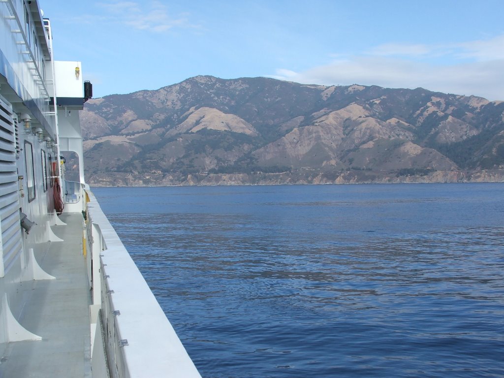
This week I had an opportunity to go out on a research cruise with the Monterey Bay Aquarium Research Institute (MBARI) to do some deep-sea exploration of submarine canyons offshore of the Big Sur coast south of Monterey.

This is different field work than I'm used to. I've mostly been studying ancient deep-sea sediments (now exposed in mountains) whereas this trip was looking at modern deep-sea sediments.

They drop an ROV attached to a cable from a ship. This ROV can fly around just above the sea floor, has a robotic arm to grab stuff, and a bunch of cameras for observation. The analogy one of the guys on the boat made was -- imagine exploring the Grand Canyon by dropping a video camera in a Volkswagen beetle from a helicopter on a cable over a kilometer in length, during a moonless foggy night.

The image above was our view of the Big Sur coastline (you can even see Highway 1 if you look hard enough) while we were sampling one of the submarine canyons below.

The image below is an image of the sea-floor topography showing the canyons and channels cutting through the continental margin. The shelf edge is to the right in the orange color and the darker blue colors are getting to deeper depths (image courtesey of MBARI).

Thursday, November 02, 2006

Rubber band in super slow-motion


Some physicists studying elasticity filmed rubber bands at super high speed capturing the process of "dynamic buckling instability".

Check out the article and the links to the movies here.